Showing posts with label Canada. Show all posts

Monday, September 23, 2019

09/02/19 - To Manitoba and into the USA

There are a lot of large farms, and a lot of water along the road.  Also a couple of miles of wind generators and oil wells.


We crossed in to Manitoba and stayed at the visitor center overnight.  They were closed by the time we got there, but there were a lot of semis in the back parking lot overnight.


World's largest freestanding banana in Melita, Manitoba, Canada.

Crossing back in to North Dakota, United States. The border guard asked about weapons, cannabis, where we were last night, how long we've been out of the US, how long our motorhome was and said he was coming inside. He came in and looked around for about 1 minute, talking about the motorhome and our traveling and then left. It was quick. He didn't ask about fruits, vegetables, plants or any other foods. Actually, none of the border crossings we've gone through did. 


For more pictures, please click here


08/31/19 - Through Saskatoon, to Lanigan, Saskatchewan rest area


Flat land and farming. We ended up going through the town of Saskatoon, thanks GPS.


Being Labor Day weekend, we stopped at the Lanigan rest area. There was a camper behind some trees when we got there and the two days we were there, there were campers/cars/vans coming and going.  It's a popular rest area and overnight spot. There's a dump station, but no water. There's also pit toilets and garbage cans.


There is a potash mine near the rest area;  it was started in 1963.


For a few more pictures, please click here.


Saturday, September 21, 2019

08-29-19 - Going around Edmonton, Elk Island NP to Battleford, Saskatchewan

There are a lot more farms and cattle and crop land. We've also noticed oil wells and oil companies.  We went around the top of Edmonton and then stopped at Elk Island National Park. From there were went on to Vegreville Walmart for the night.

You can click on the pictures to enlarge them.


Elk Island National Park plays an important part in the conservation of the American bison. The Canadian government purchased one of the last herds of bison and between 1907 and 1912 and shipped 400 wild bison by train to Elk Island National Park.  They also have elk, moose and deer. Elk Island National Park is the only national park that maintains herds of both subspecies of North American Bison; Wood Bison on the south side of the highway and Plains Bison on the north side.


From there, on to Battleford, Saskatchewan.


We stopped at North Battleford Walmart in Saskatchewan for the evening. We were going to stay at Finlayson Island, a gravel parking lot that we found on iOverlander. As we got to the bridge to cross to the island, we saw a sign that says "Bridge Restriction 8 tonne";  so we went to Walmart.

I saw this at Elk Island and thought it was cute.


For more pictures, please click here.


08/27/19 - Through Dawson Creek, BC, Grande Prairie, Alberta, Canada


Dawson Creek is "mile 0" of the Alaska Highway.  It provides a gateway to the Alaska highway, which connects Northern British Columbia, the Yukon and Alaska to southern Canada and the lower 48 states of the United States. We happened to take this way home, instead of on our way there.

You can click on the pictures to enlarge them.


We stopped at Grande Prairie Walmart for the evening, along with many other RVs. This was the first Walmart we've seen that charges to use their carts, and then the coin back when you're done and connect it to the other carts.


 To see more pictures, please click here.


08/26/19 - Fort Nelson, British Columbia, Canada

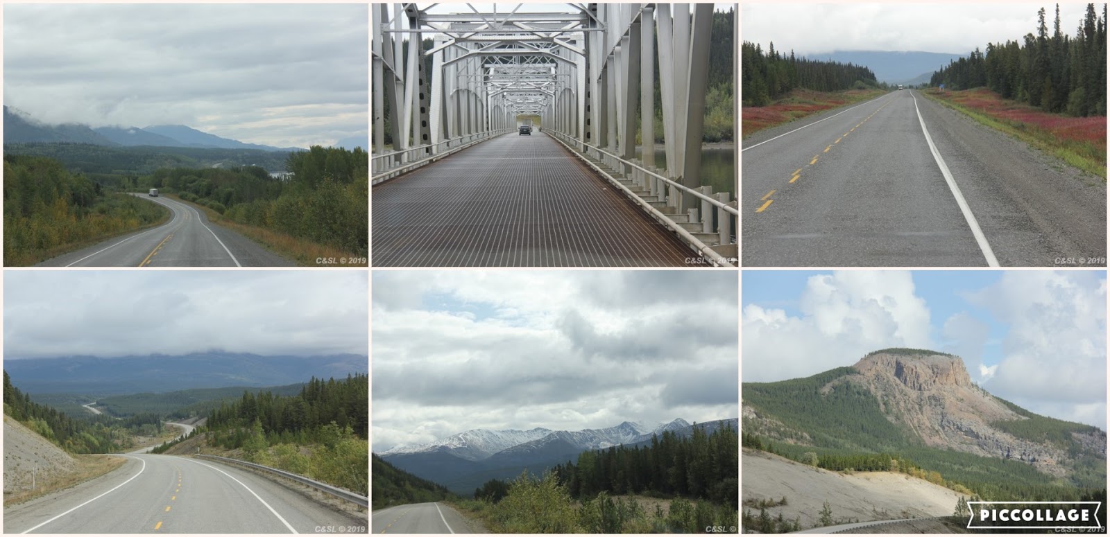
Going from Watson Lake to Fort Nelson, we drove through the Northern Rocky Mountains.  There's some beautiful areas. The highest point on the Alaska highway is Summit Lake at an elevation of 4250 feet above sea level

You can click on the pictures to enlarge them.


We stopped across the highway from Liard River Hot Springs Provincial Park; there is an overflow parking lot. There's a fee booth as soon as you turn off the highway to go to the hot springs and campground. We just wanted to go in and look around, but we found out they charge $5/person for day use, so we didn't. We have seen hot springs before. I don't know if this one has the sulfur smell the other ones have; if they do, I wouldn't want to soak in it. I know it's a very popular place.


Muncho Lake is known for its jade green color which is attributed to the presence of copper oxide leached from the bedrock below.  We stopped at a couple places along the way for pictures. 


One of the ladies at the Watson Lake visitor center said we'd see more animals along the route from Watson Lake to Fort Nelson, than we've seen anywhere. She was right. We saw wood buffalo, caribou, stone sheep and deer along the way today. Missed two bear pictures.


We stopped at the visitor center in Fort Nelson. They have free wifi and a free dump station and water next door.  A little ways from there, we stopped at a turnout at MM 245.3 for the night. What we've seen of British Columbia is that it's very clean and ditches and roads are mowed. There's a lot of litter cans and no garbage.

For more pictures, please click here.

08/25/19 - Watson Lake, Yukon, Canada

Heading on to Watson Lake. Watson Lake was an important point during construction of the Alaska Highway in 1942. The airport was one of the major refueling stops along the Northwest Staging Route.

You can click on the pictures to enlarge them.


Watson Lake Sign Post Forest was started by a homesick GI in 1942. A commanding officer asked him to repair the erect the directional signposts. While completing the job, he added a sign that indicated the direction and mileage to his hometown of Danville, Illinois. Others followed suit. They say there are over 77,000 signs. No, we did not add a sign.


The Watson Lake Visitor Center is right beside the sign post forest inside the Rec Center. There is area information and displays. They gave us a paper showing the services and attractions between Watson Lake and Fort Nelson. She told us that we should see a lot of animals along this way, especially bison.


We stopped at Allen's Lookout for the evening. This is a large gravel parking area.


For more pictures, please click here.


Friday, September 20, 2019

08/24/19 Whitehorse, Yukon, Canada

Leaving Dawson City, we stayed at Fox Lake Burn rest area for the night of the 23rd, and moving on to Whitehorse on the 24th.

You can click on the pictures to enlarge them.


It rained most of the way to Whitehorse and quit after we got there.  We were able to park at the visitor center, but it was a tight squeeze. I went inside for information while Curt unhooked the jeep. From there we went to the S.S. Klondike National Historic Site, a couple of blocks away.

Per the above website, "The S.S. Klondike was built in Whitehorse and launched in 1929. With a cargo capacity 50 percent greater than other boats on the river at that time, she was the first sternwheeler on the Yukon River large enough to handle a cargo in excess of 300 tons without having to push a barge.  Built as an ore hauler the Klondike initially operated between Whitehorse and Stewart Landing. On her downstream run she would carry freight bound for the Mayo silver mining district. On her return trip she would carry silver-lead ore from the Mayo District that had been brought down the Stewart River aboard smaller sternwheelers. The effects of the depression soon saw the Klondike moved to the Whitehorse-Dawson City run where she carried both passengers and freight.

In 1936 the Klondike was in an accident and Klondike II was built and was able to run until 1952, after roads were built and riverboat transportation not needed. She was refurbished as a cruise boat but that only lasted a couple of years. "

They do guided tours for $7.80 (adults), or self-guided tours free. Being it was still raining off and on, the top of the deck was closed, so we wouldn't be able to go up there anyway, we decided to do the self-guided tour of the main deck. 


The Whitehorse Fish Ladder and Hatchery is the largest wooden fish ladder in the world. According to Afar.com, "It help migrating Chinook salmon on the final leg of their epic journey. As young smolts, they migrate downstream to the Bering Sea. After 3-5 years, they re-enter the Yukon River and being the 2-month 3200 km swim back to their home waters. The lucky ones, a tiny percentage, will make it to spawn and die there. This 366 meter (1200 ft) chute allows the salmon to skirt the Whitehorse Dam and avoid its turbines." I only saw two salmon in the inside display area.


Going east on Highway 1, toward Watson Lake. We're going through a cold spell now.


We stopped at a large rest area past Jake's Corner for the night. For more pictures, please click here.


08/22/19 - Top of the World Highway, Border Crossing, Dawson City, Yukon

Top of the World Highway in Alaska, before the US/Canada border

The US/Canada border crossing 

Yukon Territory, Canada


The George Black ferry crossing is free of charge provided by the Yukon government. Maximum vehicle length is 83 feet. We had to wait as they loaded up smaller cars and campers. We were the only ones on our crossing. As we were driving up, the hitch snagged on something and again as we were driving off. Other than that, it was a smooth ride; kind of strange going sideways down the river through.

Dawson City also started as a gold rush city with the Klondike Gold Rush in 1896. It only lasted a few years but gold mining is still an economic mainstay in the area. We stopped at the visitor center and then walked around town. The visitor center has some films about the gold rush and a diorama of the old town.  Leaving town there are areas that were dredged and still big piles of ground.


For more pictures of Top of the World Highway and Dawson City, please click here.


Friday, May 10, 2019

05/10/19 - Past Haines Junction, Yukon


We're slowly getting closer to Alaska...

You can click on the pictures to enlarge them.

Continental Divide


Nisutlin Bay Bridge, the second longest water span on the Alaska Highway at 1917 feet/584 m.


We missed the Petro Canada station at Whitehorse, so trying to look up for truck stops on Trucker App I found one in Canyon. It’s a really small station and Curt wasn’t sure if he should fill there or just go on to Haines Junction. We knew there were some there, but without cell service couldn’t look anything up.  He put in a little bit and then we went on to Haines Junction and filled at Fas Gas. The small station charged $1.478/liter (Canadian money) and at Haines Junction it was $1.449/liter (Canadian)


We stopped at the Yukon Visitor Center which also shares the building with the Kluane National Park Service. There was no one at the National Park desk but we were able to get information from the Yukon Visitor Center ladies and I got some park stamps.


Kluane Icefields

Thachal Dhal Visitor Center was closed, but we stopped at the entrance and saw lots of Dall sheep on the mountain. It was really windy there, and dust blowing like crazy.


World’d largest gold pan

We stopped at a turnout for the night.

We saw a bald eagle, 2 rabbits, 2 moose (1 really close-up on the highway) and 2 porcupines.


For more pictures, please click here