10/30/12: At Robert Newlon AirPark at Huntinton, WV waiting for the mail to come and the rain to stop. It is a Passport America participating campground. We ended up getting some snow, which became slush with the water on the ground. At least we have electricity, so I did some baking and washing clothes.

Wednesday, October 31, 2012
Sunday, October 28, 2012
10/28/12, Sunday: Spending some time in Barboursville , West Virginia
We made it in to West
Virginia finally on 10/22. Pennsylvania
is a large state.
We were at Blackwater Falls State Park
We went to Blackwater
Falls
We went to the Canyon Rim Visitor Center and saw the New River Gorge Bridge. In October they
have “Bridge Day” where people are allowed to walk on the bridge. There is no traffic
allowed. People also can parachute from it. There’s a boardwalk down 200 feet;
I didn’t count the steps but I could feel it in my legs by the time I got back
up. The bridge is 876 feet high, an arch length of 2700 feet, bridge length of
3030 feet. It is the world’s longest single arch steel span bridge and America ’s
2nd highest bridge. There’s a gift shop across the road where I got
a smashed penny.
From there we decided to go to Barboursville, a little way
past Charleston and near the Kentucky border. On the way we’ll fill fuel
at Pilot. We want to see if we can stay in that area for a few days and get our
mail sent. We need the insurance papers and vehicle tags for the Jeep. Back to the twisty/turny roads again. As we got down to the bottom, we were right
beside the New River most of the way. We
passed a lot of coal mining areas. There
were a lot of places we wished we could have stopped for pictures, but no areas
to stop along the way for us. We got to Gauley Bridge
Lots of little towns along the water, and very few that had
nice looking houses. Most of the back roads of Pennsylvania ,
New York and West Virginia we noted a lot of old
buildings. They don’t tear down their old barns/sheds or fix them. Don’t know
if it’s a property tax thing or what.
Looks like more of the poorer areas of the states.
Saturday, October 20, 2012
10/19/12: After checking out of the campground we decided to go to Lowe's in Somerset. Curt needed to return some things and we thought we'd catch up on some internet stuff since we didn't have really good reception at the campground. Spent most of the night trying to work out where we are going into West Virginia and Kentucky.
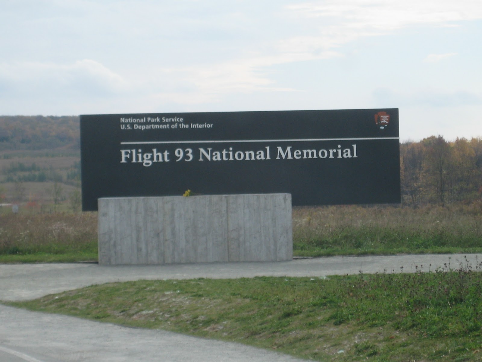
10/18: Went to the Flight 93 National Memorial, which the National Park Service is still in the process of building. Only family is allowed to go to the actual area where the plane went down, the memorial is beside it. From there we went to the Quecreek Miners Memorial. This is on the farm where they were rescued. The people there still farm and milk cattle; but decided to put up a memorial since people had been coming to see the area. They talk to all the people who come, show the movie that Disney made and explain what is true and what wasn't :) They have a map of the mine there and explained what happened. they have the rescue chamber on site and some other artifacts from then. Some Amish from Ohio put up their building, they couldn't get local contractors to work with. It was really interesting talking with them. I did buy their book when we left. I have read the book that the miners wrote, but this is from another perspective.
10/16: On the way to the Hickory Hollow Campground near Rockwood, PA we went through Punxsatawney. They have fiberglass statues of groundhogs (Punxsatawney Phil) painted throughout town. Again, not a very easy drive through town or parking availability for an RV. Parking meters downtown, but still very narrow streets, so we didn't stop. We saw advertising for Johnstown Flood National Memorial so decided to stop at that. It is a National Park Service site, so it was free with our National Park Pass, not that they checked. Otherwise it would have been $4/person. There was a film that showed what happened and we could see the area affected outside. Lots of people and some towns wiped out when the dam broke. Got to the campground around 4:00, in the bottom tier by ourself - nice. Curt wanted to do some work on the RV again and I wanted to wash clothes, so we decided to stay a couple days. With Passport America we can still through Thursday at only $14.50 a night. There's seasonals in one area, but this must be a relatively newer campground because they all look nice. A few campers on a top section.


Monday, October 15, 2012
10/14/12: Saw the Kinzua Dam and drove around the hills. There is an area called "Jake's Rocks" that we stopped at and took pictures. Went on to Warren, PA Walmart. Windy area here. Did FaceTime with the grandchildren tonight. Thanks girls!
10/13: Yup, got cold last night, 27 degrees. Glad we had
our 2 little heaters able to be plugged in. Got a later start due to the cold,
didn’t really want to go sight-seeing/hiking until it warmed up a little bit.
Went to Kinzua Bridge State Park
10/12: Left Mansfield and
took Rt 6 and then 59 to go to Warren ,
PA Allegheny National Forest
10/11: We went to the Grand Canyon of Pennsylvania. It has a
small visitor center and gift shop there. It’s free, basically scenic overlook
areas into the canyon and some hiking trails. One of the trails was supposed to
be rated as more difficult, so I chickened out; a mile-and-a-half down to the
bottom of the canyon and then back up. There was a shorter one, not quite a
mile, which took us to another scenic lookout which was really pretty. That
went down and up just a little bit, but enough that I was glad that I had my
hiking shoes on and my pole with. The canyon would have been prettier with the
trees still having leaves on, but we’re too late for most of them. Curt still got some pretty pictures though.
When we got back to the Jeep, the battery was dead again. Terrific. We waited
for a little while until a guy was coming back to his vehicle in the parking
lot and Curt asked him if he could jump it. We had battery cables with. Got it going.
10/05/12: Friday: Drove through the White
Mountain Forest. We were going to go to Castle in the Clouds, but they charge for the drive up there, and then again to see the castle. Nope.
Wednesday, October 3, 2012
Wednesday, October 3, 2012: We just checked into Beaver Hollow Campground at Ossipee, NH, another Passport America campground. Yup, we're back in New Hampshire already. As we've been searching campgrounds, we're finding that a lot of them in the northern/eastern part of the country close October 15th. So, instead of going all the way up and back from Acadia National Park, which would be another 400 miles or so, we just decided to start heading back. The trees are really pretty; some red, yellow and still greens. Interesting some trees already dropping their leaves. Near Beaver Hollow is the White Mountain National Forest and Castle in the Clouds which we plan on going to; hopefully not raining.
Monday we went south of Wells, along the coastline, and found a beach area to walk on. There were some kids running in the water (don't know why they weren't in school), but the water was too cold for me to walk in in my opinion. We saw Nubble Lighthouse. It was free, but we couldn't go on the island itself where the lighthouse is. Got lots of pictures. It's a really pretty area. The huge rocks are amazing around here. Tour buses all over. Fort McClary, an old fort, was open, and it was free also. Kind of nice not being around tourist season for some things. We went to Kittery Trading Post, which is much like Cabela's but I think it is more into guns and hiking. Even though there is a lot of everything. It's two levels also like Cabela's, but doesn't have near as many animals.


Tuesday we went north up to South Portland and then back along the coastline. We saw Portland Head Light lighthouse at Fort Williams Park at Cape Elizabeth. Again, huge rocks. It was a fort, so there's still some blocks leftover from buildings. Everything was free again (nice!) Lots of tour buses again. We stopped at Scarborough at Len Libby Chocolatier. They have a life-sized moose made of chocolate. That's probably the only moose we'll see! We stopped at Kennebunkport and walked around. We had been there back in 2007 with Dean and Valerie, and remembered a lot of the area, and found the ship, Eleanor, that they had a ride in. Lots of road construction.


Subscribe to:
Posts (Atom)